
AI-powered pavement management that transforms complex GIS data into visual intelligence your team and council can actually use.

Other tools show data. We deliver decisions.
Why AMS Insights
Generic GIS tools force you to become a software expert. We built purpose-specific tools that speak your language.
Platform Capabilities
From field inspection to council presentation, AMS Insights handles the entire workflow.
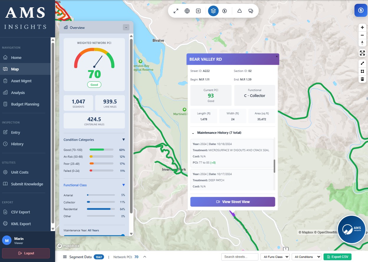
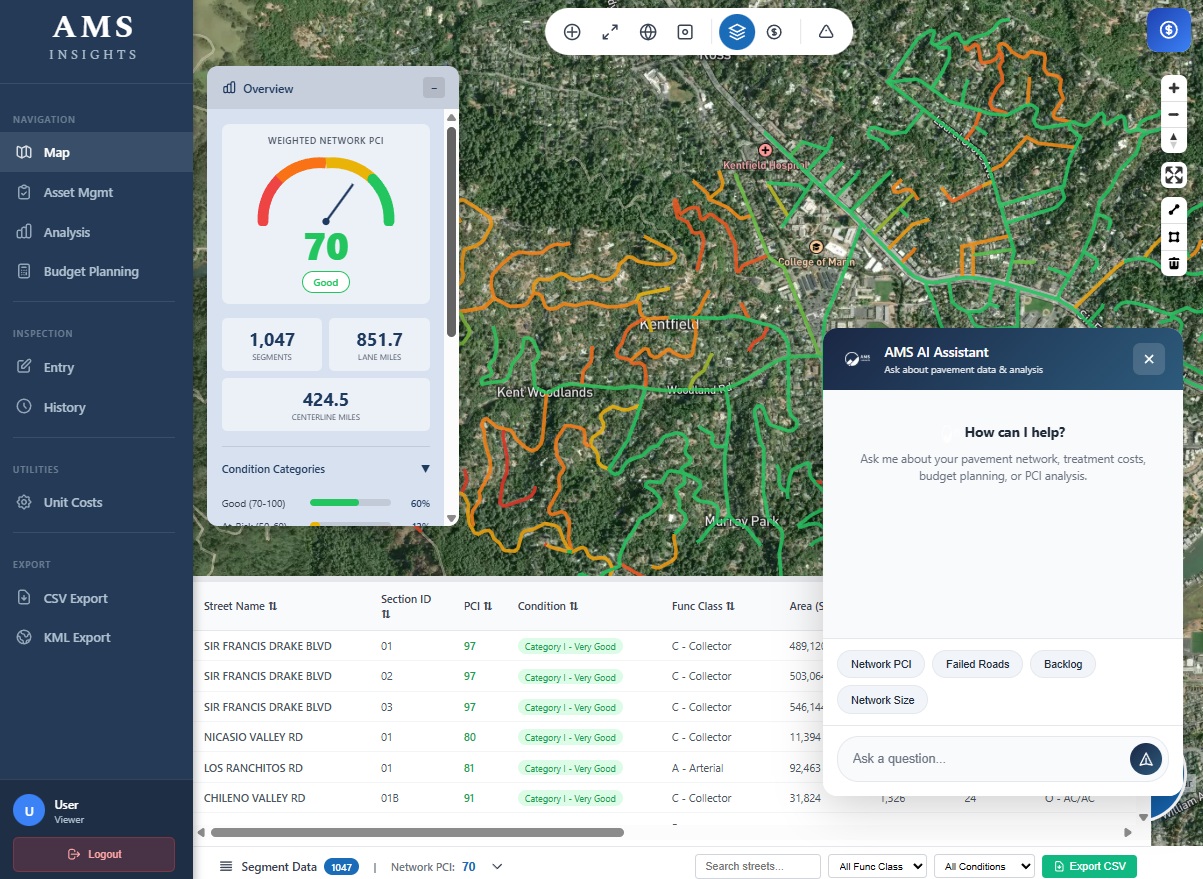
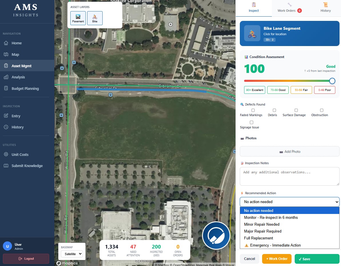
Color-coded street segments with real-time condition data. Click any segment for detailed history, treatment recommendations, and cost estimates.
Capture and view photos pinned directly to map locations. Every image is automatically tagged with GPS coordinates for precise field documentation.
Project customized ortho imagery directly into your maps. Overlay high-resolution aerial photography for enhanced visual analysis.
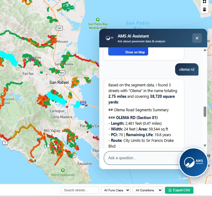
Ask questions in plain English: "Show me roads in poor condition near schools" or "What's our 5-year maintenance backlog?" Get instant, actionable answers.
Model different funding levels and see exactly how they impact your network condition over 5, 10, or 20 years with industry-standard deterioration curves.
Generate executive summaries, budget justifications, and visual reports that communicate clearly to elected officials and residents.
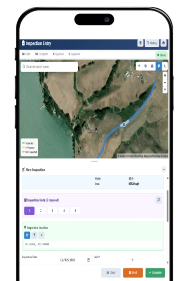
Mobile-friendly inspection tools that sync automatically. Capture distresses, photos, and notes directly from the field with GPS location tagging.
Work together in real-time with shared maps, comments, and annotations. Keep your entire team aligned with centralized project tracking.
Expand beyond pavement to manage sidewalks, curb ramps, street signs, traffic signals, trees, and storm drains—all in one platform.
Seamlessly integrate with ArcGIS, Esri, and other commercial off-the-shelf asset management systems. Connect your existing workflows without disruption.
Direct connection to StreetSaver for seamless data synchronization. Keep your pavement management data up-to-date across systems.
Need something unique? We build customized web applications tailored to your agency's specific workflows, reporting requirements, and operational needs.
Solutions By Role
Whether you're presenting to council or planning next year's budget, we've got you covered.
Stop scrambling before council meetings. AMS Insights gives you instant access to the data and visuals you need to justify your budget requests and demonstrate ROI on maintenance investments.

Dive into segment-level data, run what-if scenarios, and plan treatments with precision. Industry-standard PCI calculations and deterioration modeling built in.
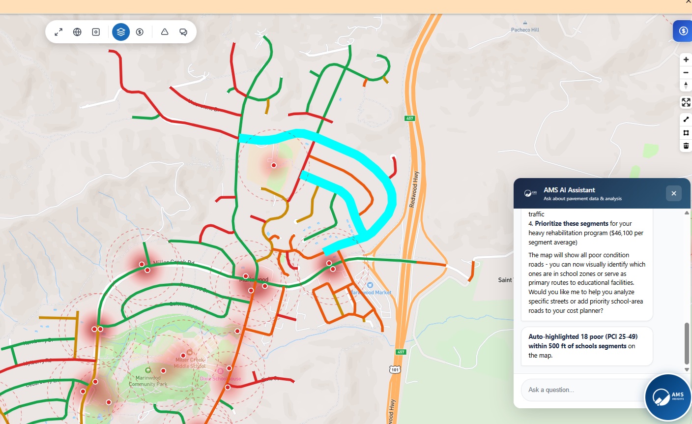
See exactly where infrastructure dollars should go. Model different funding scenarios and understand the long-term cost implications of deferred maintenance.

Serving 70+ cities, counties, and regional agencies
Simple Pricing
Stop wrestling with spreadsheets. Start making decisions your council will support.
Comprehensive Coverage
From pavements to utilities, manage all your infrastructure in one platform.
Whether you're ready for a demo or just have questions, we're here to help. Most agencies are up and running within a week.